|
一股東北季候風為廣東沿岸帶來乾燥的天氣。本港地區下午及今晚天氣預測大致天晴,但部分地區有煙霞,天氣乾燥。吹和緩東北風,離岸海域風勢間中清勁。展望:明日及星期一大致天晴,早上天氣清涼。隨後數天氣溫逐漸回升。 |
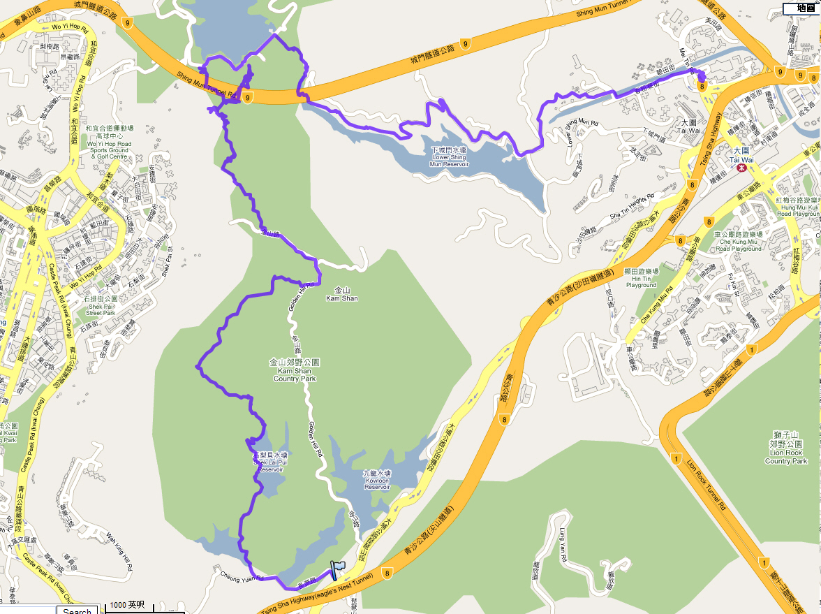
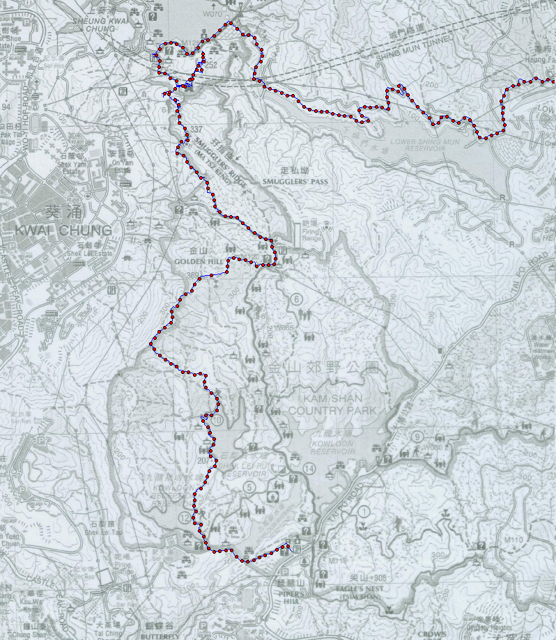
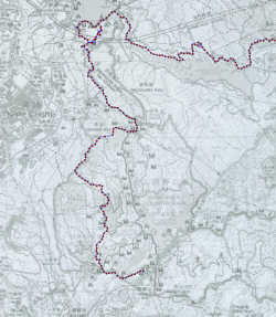
Route: GPX Reference file.

 星期六上午半日遊 《湖貝金山城門堡》
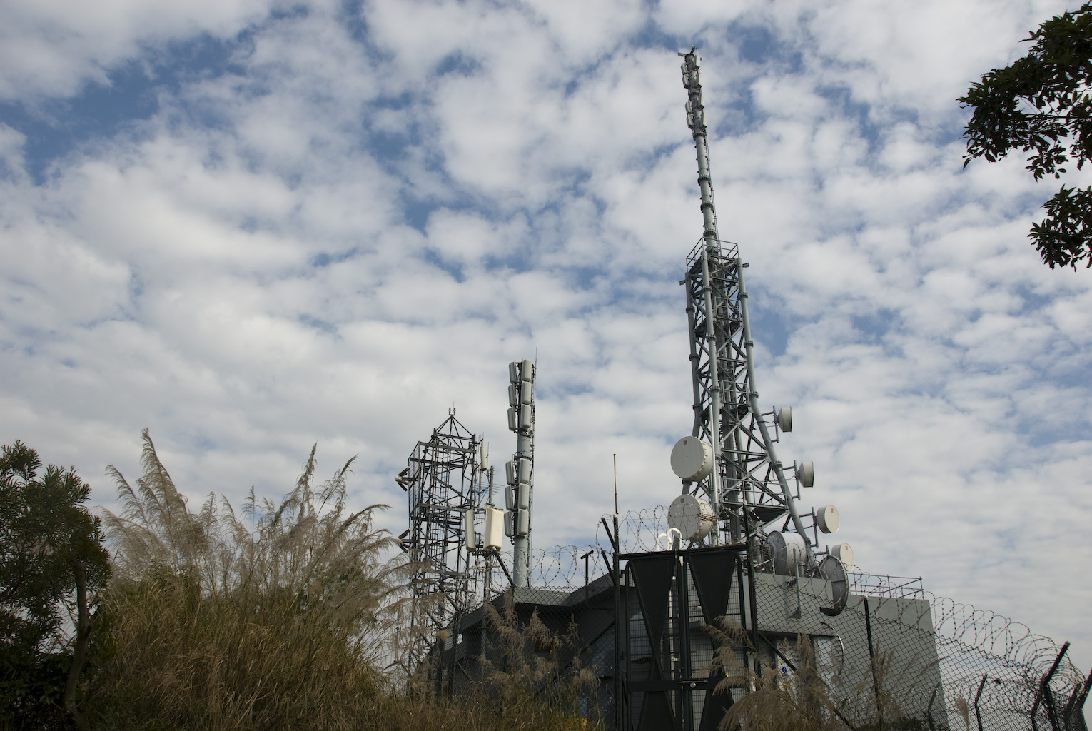
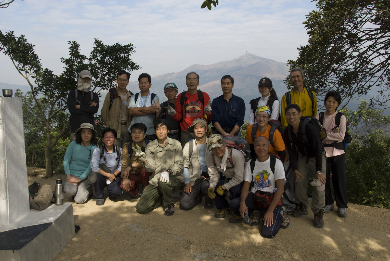
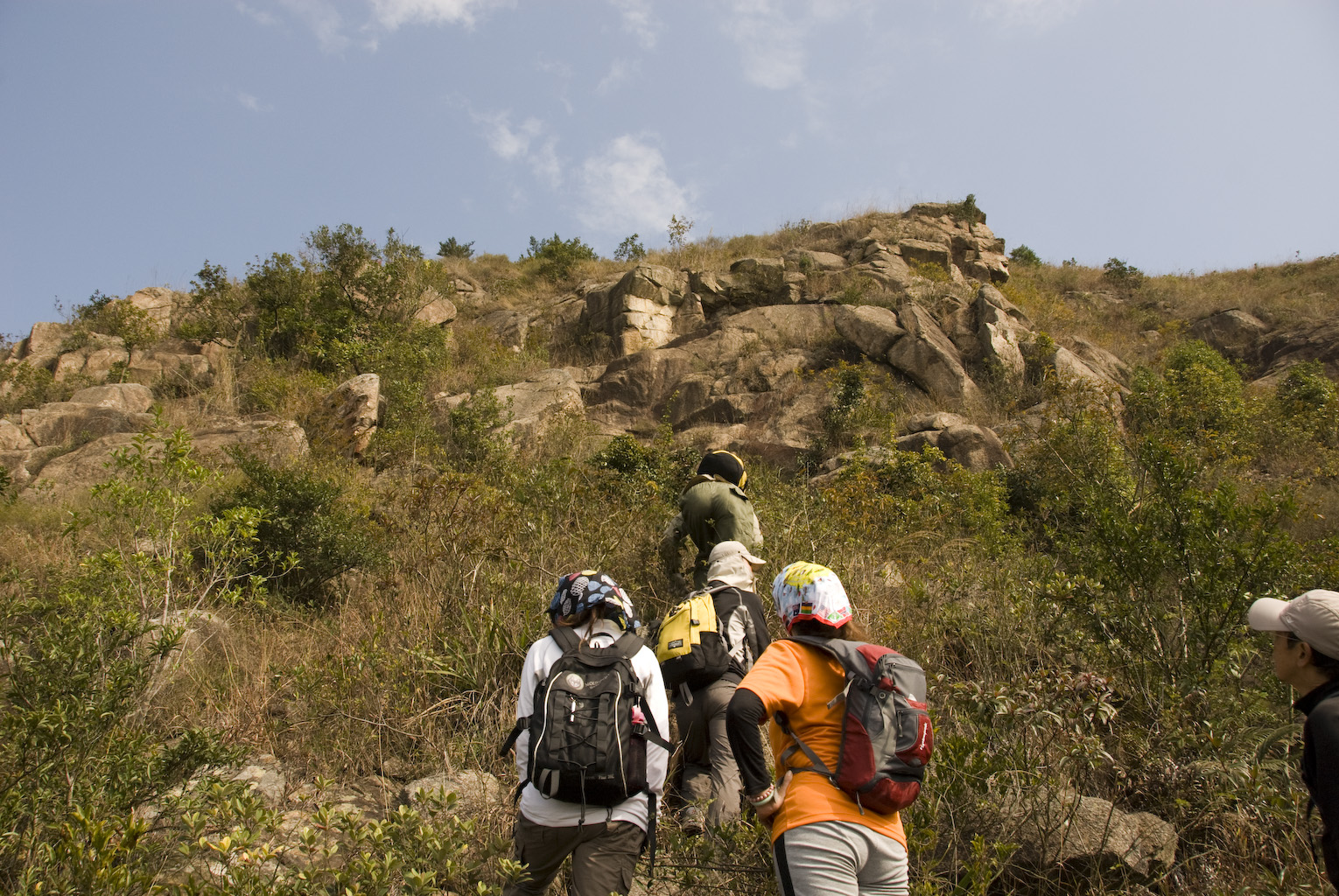
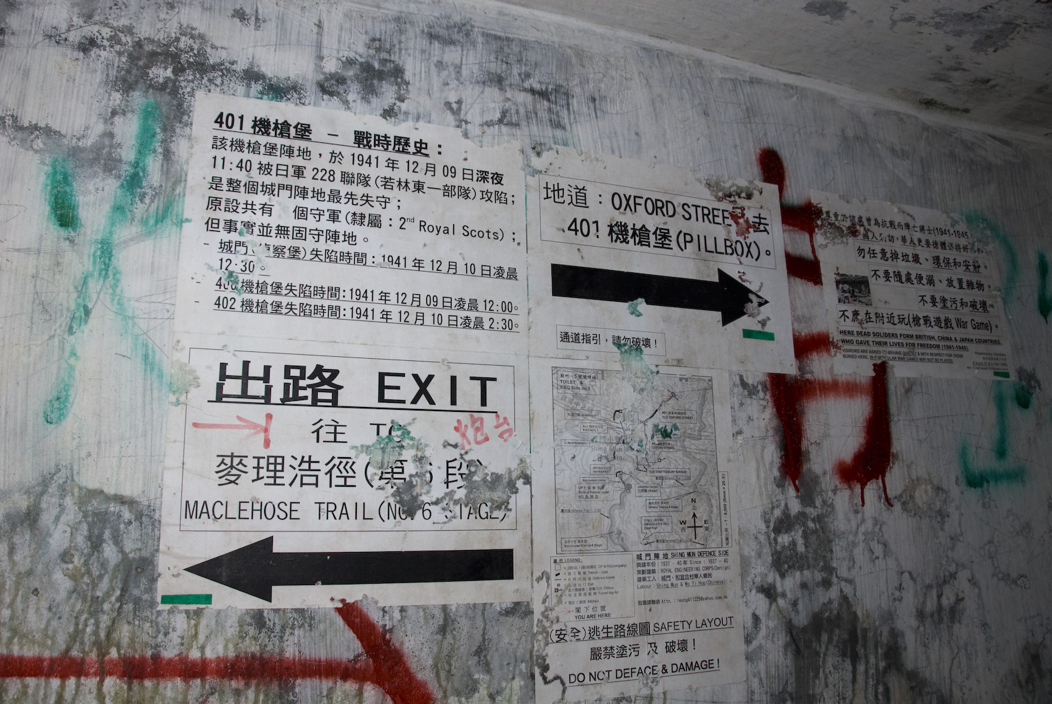
2010年1月16日晨8:30長沙灣地鐵站內C出口或9:00大埔道馬騮山86B巴士站集合。金山郊野公園遊石梨貝上下水塘,石梨貝上塘攀溯西北坑澗、覓隱徑登遊金山,金山山火瞭望台下金山路,孖指徑攀石林山坡登走私坳,麥理浩徑進攻醉酒灣防線之城門地堡(備手電筒),城門車路走捷徑下石蔭村車站散隊或茶樓飲下午茶。(旅行路線或有更改,視當時環境情況及時間而定。)短暫時間乾糧大休。約下午二時完成整個旅程。難度︰★★★★半。 星期六上午半日遊 《湖貝金山城門堡》
2010年1月16日晨8:30長沙灣地鐵站內C出口或9:00大埔道馬騮山86B巴士站集合。金山郊野公園遊石梨貝上下水塘,石梨貝上塘攀溯西北坑澗、覓隱徑登遊金山,金山山火瞭望台下金山路,孖指徑攀石林山坡登走私坳,麥理浩徑進攻醉酒灣防線之城門地堡(備手電筒),城門車路走捷徑下石蔭村車站散隊或茶樓飲下午茶。(旅行路線或有更改,視當時環境情況及時間而定。)短暫時間乾糧大休。約下午二時完成整個旅程。難度︰★★★★半。
(
 由於相片已 post 過久時間, 大部原相已刪除, 只留index作記錄回味. 唯保留以下數張作行程重點recall 由於相片已 post 過久時間, 大部原相已刪除, 只留index作記錄回味. 唯保留以下數張作行程重點recall
Shing
Mun Redoubt was positioned above the Reservoir with five machine gun
pillboxes, a command post, artillery observation post and five open
firing positions, complete with fire step. The plan below is believed
to have been prepared by a Mike Nolan, possibly of the British
Garrison in Hong Kong in the 1970s or 1980s. The map was supplied by
David Russell, a Superintendent in the Royal Hong Kong Police, who
lectured the military and others on the invasion of Hong Kong .
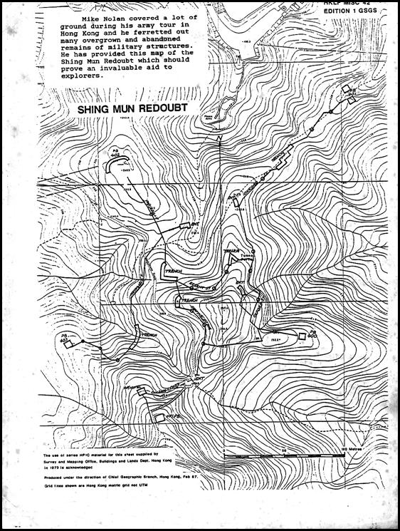
http://hksw.org/Shing%20Mun.htm#_ftn3
|

 page 2
page 3
page 4
page 2
page 3
page 4
全程用
Nikon D200
+ Nikon AFS18-200VR +
(註: 相片EXIF內附 GPS位置 數據) +
GPS track log by Qstarz BT-Q2000 ; 如慾了解 更多 相裡面 GPS的 換算, 請到
GPS.
| 總時間 (時:分:秒) |
05:13:46 |
21:15 pace |
| 移動時間 (時:分:秒) |
03:13:18 |
13:06 pace |
| 距離 |
14.8 km |
| 移動速度 |
4 km/h 平均 |
|
| 高度增量 |
+389m / -508m |
| 卡洛里 |
709.0 KCal |
|
| 距離 |
14.8 km |
100.0 |
| 上升 |
3.8 km |
25.4 |
| 下降 |
5.2 km |
35.2 |
| 平面 |
5.8 km |
39.3 |
|
| 高度增量 |
389 m |
| 下降高度 |
508 m |
| 淨高度變化量 |
-118 m |
|
|
|
|
|
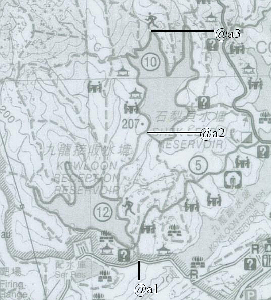
@a3
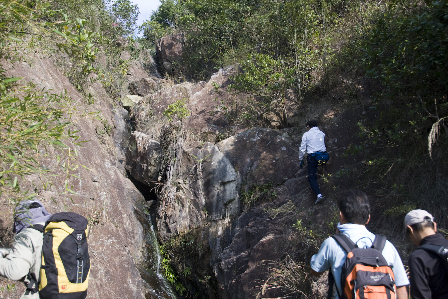
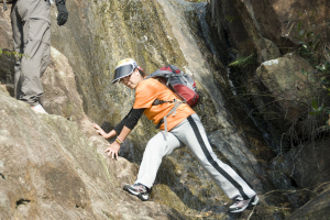
入澗口, 有一個壁仔. |
|
|
|
|
|
|
|
|
|
|
|
|
|
|
|
|
|
|
|
|
|
|
|
Ann
|
|
|
|
|
|
|
|
|
|
|
|
|
|
|
|
|
|
|
|

|
|
Wendy
原來是外國姑娘. 失敬. |
|
|
|
|
|
|
|
|
|
|
|
|
page 2
page 3
page 4
Email
me
|